www.monumentaustralia.org
Flying Officer Thomas CrowPrint Page 
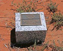
The plaque commemorates Flying Officer Thomas James Russell Crow who was killed when his Kittyhawk aircraft crashed in November 1943.
Location
| Address: | Eastmond Road, Merrinee, 3496 |
|---|---|
| State: | VIC |
| Area: | AUS |
| GPS Coordinates: | Lat: -34.295157 Long: 141.865545 Note: GPS Coordinates are approximate. |
Details
Dedication
| Approx. Monument Dedication Date: |
|---|
Front Inscription
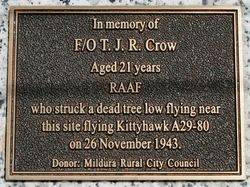
In memory of F / O T. J. R. Crow
Aged 21 years RAAF who struck a dead tree low flying near this site flying Kittyhawk A29 - 80 on 26 November 1943.
Donor : Mildura Rural City Council
Left Side Inscription
Back Inscription
Right Side Inscription
Inscription in Proximity
Source: MAMonument details supplied by Monument Australia - www.monumentaustralia.org.au


